Category Archives: daytrips

Walk Albuquerque

WALK Albuquerque is dedicated to creating and enhancing opportunities for walking in Albuquerque and surrounding communities. We are committed to transforming our region into a place where people of all ages and abilities can safely and easily walk to schools, parks, job sites, shopping opportunities, public transit stops, and other destinations.

http://walkalbuquerque.org/

Georgia O’Keeffe’s Inspiration for Black Place?

I am a docent at the Georgia O’Keeffe Museum and we are currently showing 2 beautiful pieces that she did called “Black Place.” I am told that this place is in Chaco Canyon. Could you tell anything more about it or how I might find it on a hike ?

I found the following, which includes a picture of Black Place II (I haven’t seen either before).

Georgia O’Keeffe: Black Place II (59.204.1) | Object Page | Timeline of Art History | The Metropolitan Museum of Art

“The Black Place was the name O’Keeffe gave to one of her favorite painting sites, located in the Bisti Badlands in Navajo country, about 150 miles northwest of her home in Ghost Ranch. It was a stretch of desolate gray and black hills that the artist said looked from a distance like “a mile of elephants.” Isolated far off the road and away from all civilization, O’Keeffe made several camping trips there in the 1940s, with her assistant Maria Chabot. Writing to Stieglitz in 1944, the year Black Place II was made, Chabot described in words what O’Keeffe captured in paint: “… the black hills—black and grey and silver with arroyos of white sand curving around them—pink and white strata running through them. They flow downward, one below the next. Incredible stillness!” (Maria Chabot—Georgia O’Keeffe: Correspondence 1941–1949, 2003, p. 193). Over a period of fourteen years, from 1936 to 1949, her visits to the Black Place sparked a torrent of work that was almost unparalleled in her career. Between 1944 and 1945 alone, she completed six canvases, including Black Place II, one very large pastel, and at least nine pencil sketches.”

http://www.metmuseum.org/toah/hd/geok/hod_59.204.1.htm

I can’t verify the description, but I have been to Bisti-Denazin and recommend you visit the area. I think it would be very hard to pinpoint the exact spot she loved so — perhaps someone at Ghost Ranch has an idea. See
http://www.desertusa.com/mag00/may/stories/bisti.html for a description of Bisti-Denazin. It makes for a long daytrip from Santa Fe. You wouldn’t want to be there in June-July-August, unless very early in the day.

Here are two sites with photographs of the area — maybe you’ll see something here or perhaps the photographers have seen Black Place.

Denazin Wilderness Photo Images
http://www.robertchavez.com/chavez/denazin/index.html

http://www.flickr.com/photos/tags/bisti/

I hope this helps. mjh

The Road to Riley, New Mexico

map route to Riley, New MexicoWe started this day trip driving to the trailhead for the Chupadera Peak trail, a few miles north of the Bosque del Apache National Wildlife Refuge visitors center. Though we’ve known of this trail for awhile, we’ve never stopped, preferring to go on to view the birds in the bosque. This day, the trail was our destination. (Click this map thumbnail for larger image –>)

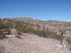
Chupadera Peak, New MexicoTurning off the main road south of San Antonio, the dirt road goes under a railroad trestle and ends at a line of small, struggling cottonwoods. The beginning of the trail can be a loop, with one leg to the left of the trailhead sign and the other to the right (this shorter leg is .5 miles). Both of these legs cross innumerable sandy washes that look just like nicely maintained trails — watch for cairns. The two legs meet by climbing either side of a low hill. At their juncture is a bench facing the bosque and the start of the “real” trail to Chupadera, another 4.3 miles west.

Though it was early March, it was also noon on a day of record heat (70’s). An occasional breeze made it bearable to the people, but the dog was walking on his tongue from the start. He stuck his head under the slatted bench for some respite. We only went a little farther. This might be a better mid-winter hike. Regardless, one needs to hit the trail well before noon. Eventually, the trail passes under I-25 and up to Chupadera. At over 9 miles of desert trail, I imagine few of Bosque’s many visitors have made the hike.

Still, that little bench on the hill has a panoramic view of the Rio Grande valley and the northern ponds of the refuge.

[more text and photos…]

Continue reading The Road to Riley, New Mexico

Bosque del Apache National Wildlife Refuge

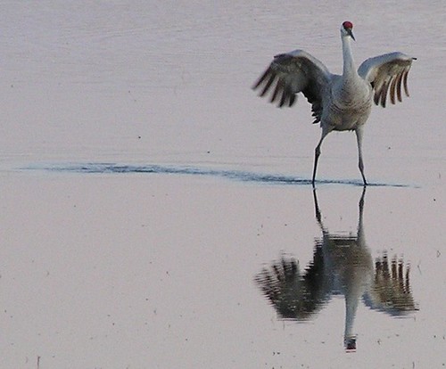
sandhill crane

Tour Loop Bosque del Apache National Wildlife Refuge
Bosque del Apache National Wildlife Refuge is located in the beautiful Land of Enchantment, New Mexico near the small town of San Antonio, NM. The Refuge is just east of Interstate 25 midway between Albuquerque and Las Cruces, just south of Socorro.

To reach the refuge from Socorro, drive nine miles south on I-25 to exit 139, go east one-fourth mile on US 380 to the flashing signal at the village of San Antonio, turn right onto Old Highway 1, and drive south nine miles to the Visitor Center.

From Las Cruces, drive north on I-25 to exit 124 (San Marcial), then north on Old Highway 1 to the Visitor Center. The entrance to the scenic tour loop for vehicles is just south of the Visitor Center.

mjh’s blog — Trip to Bosque

Bosque del Apache – a photoset on Flickr

Colorado Hiking Trail List

Colorado Hiking Hike List

The hikes are broken down into 5 groups depending on what city they are roughly west of (or near to in a few cases). The cities are, from north to south: Ft. Collins; Denver; Colorado Springs; Pueblo; Walsenburg. All these cities have major roads heading west into the mountains. Each hike has its own webpage that is linked to the names below.

[mjh: nice job; obviously a labor of love. Trail descriptions include driving instructions and photos.]

National Parks a Low-Cost Destination

National Parks a Low-Cost Destination Associated Press

Less-visited national parks with no entrance fees include:

· Isle Royale in Michigan, offering timber wolves and moose.

· North Cascades in Washington state, with its glaciated and jagged terrain for technical climbs and hikes.

· Great Basin in Nevada, featuring a remnant glacier, tunnels and caves.

· Congaree in South Carolina, a swamp protecting the nation’s last southern bottomland hardwood forest.

· Voyageurs in Minnesota, a wilderness for canoeing.

· Redwood in California, featuring the world’s tallest trees.

· Channel Islands in California, home to sea birds and sea lions.

Acoma’s Sky City Cultural Center and Haak’u Museum, New Mexico

Sky City Cultural Center links present to past By Tamara N. Shope, Tribune Reporter, June 9, 2006

IF YOU GO

What: Acoma’s Sky City Cultural Center and Haak’u Museum.
Where: Sky City Pueblo, 12 miles southwest of I-40 from Exit 102.
When: 8 a.m. to 7 p.m. during the summer; 8 a.m. to 4:30 p.m. during the winter.
How much: The museum and cultural center are free. Tours of Sky City: Adult, $10; seniors $9; youths $7. A still-camera permit is $10.

Call (800) 747-0181.

The $15 million Sky City Cultural Center and Haak’u Museum offers new experiences for tourists, in a setting very familiar to Acomas

ACOMA – It’s peculiar how swiftly a sense of grandeur can swallow up a traveler.

But when a long road disappears below a rocky, dusty hill in Acoma, a valley suddenly opens up as wide as the sky.

At the same time, Sky City, with its worn, modest homes and whitewashed walls and thousands of years of history, brings with it a sense of belonging.

A series of towering, sandy rocks and, sometimes, wayward cattle greet the traveler, usually a visitor looking to connect with an ancient city.

The road through grandeur branches off I-40 about 45 minutes west of Albuquerque. It heads southward, winding to a village on top of a mesa and, now, to its cultural center and museum – which, like the valley, has become priceless to the community.

The $15 million project was designed to look and feel like home for Acomas, and the community it was built for hopes it can help sustain 2,000-year-old culture.

The VLA — Very Large Array — West of Socorro, New Mexico

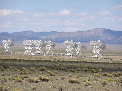
The Very Large Array

[mjh: photo above is mine; article below is not mine.]

Jack Ehn: Desert shine

For me, the radio telescopes [of the Very Large Array] beat the pyramids of Egypt, the Great Wall of China and other wonders in awesomeness, poignancy and respect for the Homo sapiens endeavor. That’s no exaggeration.

I remember being struck speechless the first time I emerged from the trees along U.S. 60 and saw the dishes of the VLA – cocked attentively, like huge, mechanical white poppies, toward the vastness of space. It was 1980, the year the VLA was officially dedicated. In 2006, its power to observe and astonish is increasing, as it undertakes ongoing upgrades and expansions.

The contrast the dishes make with the remote, desolate Plains of San Augustin is stunning.

The plains are the remains of a broad, Pleistocene Era lake, and they look it, in all their post-glacial serenity. The hills and trees that ring it and the gently rolling lake bed itself are made by nature – random, ragged, simple, solemnly gorgeous and content to be exactly what they are.

The dishes, 82 feet wide and nearly as tall as 10-story buildings when pointing straight up, cut across the skyline like a precision blade. There are 27 of them, arranged along railroad tracks in a Y-shaped configuration that can grow to 22 miles in diameter when fully extended. Anything but random, they focus in unison on unseen objects, with an unearthly intensity.

The array is mankind’s most dramatic, visible connection with the infinite. …

This Guy Was Lucky — Some Aren’t

Every year, people get lost and need rescuing in the Sandia Mountains, which are right on the edge of New Mexico’s largest city, Albuquerque. The hiker in this story was in even more rugged and remote country. A dayhike can become a death march. mjh

DenverPost.com – Taste of state left hiker hungry By Monte Whaley, Denver Post Staff Writer

Terry Harlon got that taste of the Colorado wilderness he wanted so badly.

“In fact, I got a little more of the Colorado country than I bargained for,” said the soft-spoken, 48-year-old.

Harlon took off for a day hike at Rocky Mountain National Park on May 25. A week later, the Louisiana man was spotted by a helicopter after spending a week lost in the park’s backcountry.

Harlon spent Friday at St. Anthony Central Hospital, recovering from dehydration, sunburn and the effects of not eating for a week.

Rescued hiker glad to be alive By Katie Kerwin Mccrimmon, Rocky Mountain News

He had set out May 25 and lost the trail as he began “slipping and sliding and sinking” in the snow. He was doing a loop hike and kept thinking it would be shorter to continue on the loop rather than retrace his route. He had come to Colorado to scout Rocky Mountain National Park and bring his wife back for a trip this summer.

Harlon was wearing jeans, hiking boots, a flannel shirt and a light jacket. He had only a daypack with an apple and sunflower seeds. Once darkness settled in that first day, he knew he would have to spend a night out. For the next four days, he tried to find a trail or road.

But one day stretched into a week. Harlon was getting weaker and weaker and knew he wouldn’t survive much longer.

“The night before they found me, I had come to the conclusion that I could only last a few days,” Harlon said.

Sky City Cultural Center and Haak’u Museum at Acoma Pueblo

Tribal events, sites contribute to NM’s tourist traffic – Albuquerque – MSNBC.com By Harlan McKosato, New Mexico Business Weekly

The newest tourist attraction on tribal lands is the Sky City Cultural Center and Haak’u Museum at Acoma Pueblo, 45 miles west of Albuquerque, opening May 27. The $15 million, 40,000-square-foot building evokes the Acoma ancestral architecture at Mesa Verde and Chaco Canyon.

There will be interactive components in the museum, such as a chance to bake bread in an outdoor oven, or horno. Tours will take visitors atop the 370-foot sandstone mesa, home of the Acoma people for 2,000 years.

“Acoma has been involved in the tourism industry since the 1940s,” says Brian Vallo, director of the new cultural center and museum and an Acoma member.

In the 1970s, Acoma built a tourist center at the base of the mesa. This housed a museum, gift shop and food service. In May of 2000, the tourist center burned down and the tribal council approved a plan to rebuild. But first they decided to take a closer look at the tourism industry in New Mexico and funded a market study. As a result, the council decided to build the cultural center and museum.