
Aerial imagery of the Wallow Fire in Arizona | Google Earth Blog
Started on May 29, the Wallow Fire, located near the Arizona and New Mexico border, had already burned 389,000 acres when Landsat captured a stunning aerial image of it on June 7.
Smoke from the fire has affected air quality as far north as Wyoming and as far east as Georgia. The U.S. Geological Survey and NASA cooperate closely in managing the Landsat program and we have them to thank for images such as this.
To view it yourself in Google Earth, simply download this KML file.


Aerial imagery of the Wallow Fire in Arizona | Google Earth Blog
As usual, Boston’s The Big Picture has some great photos, although I hate scrolling to see them.
Arizona wildfire rages on – The Big Picture – Boston.com
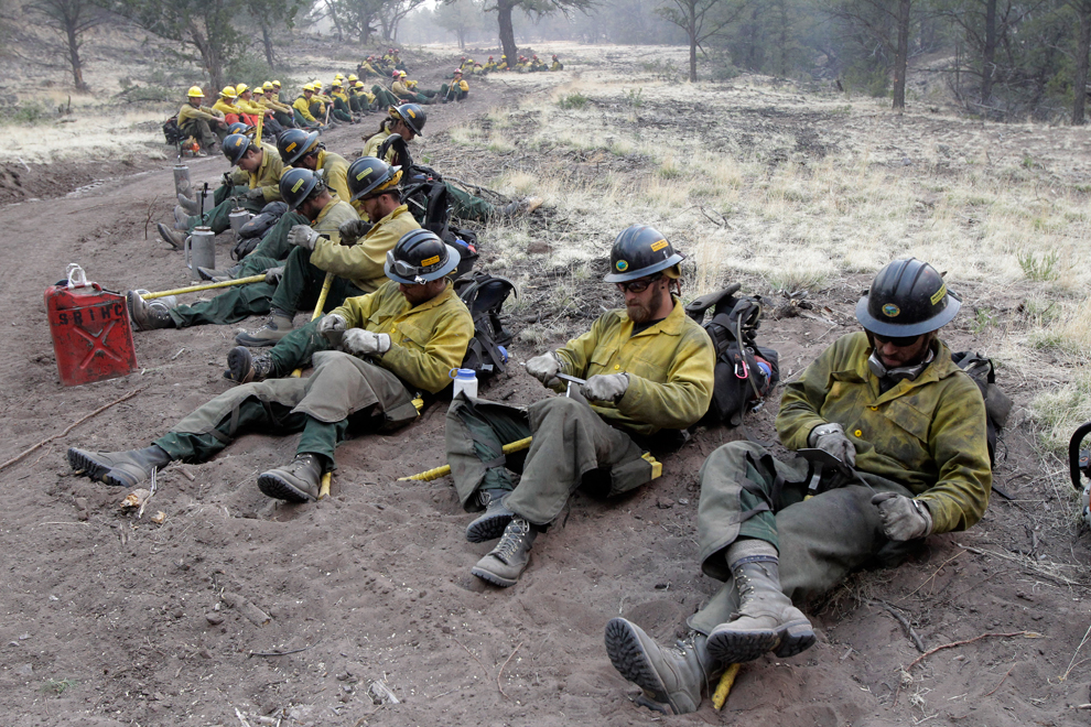
2 Fire crew members sharpen their tools as they prepare for a back burn operation in Eagar, Arizona. A raging forest fire in eastern Arizona has scorched an area the size of Phoenix, threatening thousands of residents and emptying towns as the flames raced toward New Mexico, June 8, 2011. (Jae C. Hong/Associated Press) #
Arizona wildfire rages on – The Big Picture – Boston.com
June 2011 Arizona fires seen from space | Earth | EarthSky
Three images taken from space of the Wallow North fire in Arizona in June 2011 show the fierce magnitude of this event.
June 2011 Arizona fires seen from space | Earth | EarthSky [via Arizona Hiking]
Arizona Wallow fire: Are wildfires getting worse? – By Jeremy Singer-Vine – Slate Magazine
Are large American wildfires becoming more common?
Yes, at least in the West, home to most of the nation’s largest wildfires.
Arizona Wallow fire: Are wildfires getting worse? – By Jeremy Singer-Vine – Slate Magazine [via dangerousmeta]